
De plus en plus souvent, des liaisons traversant l’océan Atlantique sont signalées sur hflink.net.
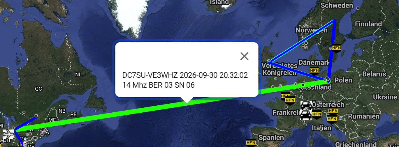
Nous espérons que cela augure d’un avenir marqué par la coexistence entre les États-Unis et l’UE.
De plus en plus souvent, des liaisons traversant l’océan Atlantique sont signalées sur hflink.net.
Nous espérons que cela augure d’un avenir marqué par la coexistence entre les États-Unis et l’UE.
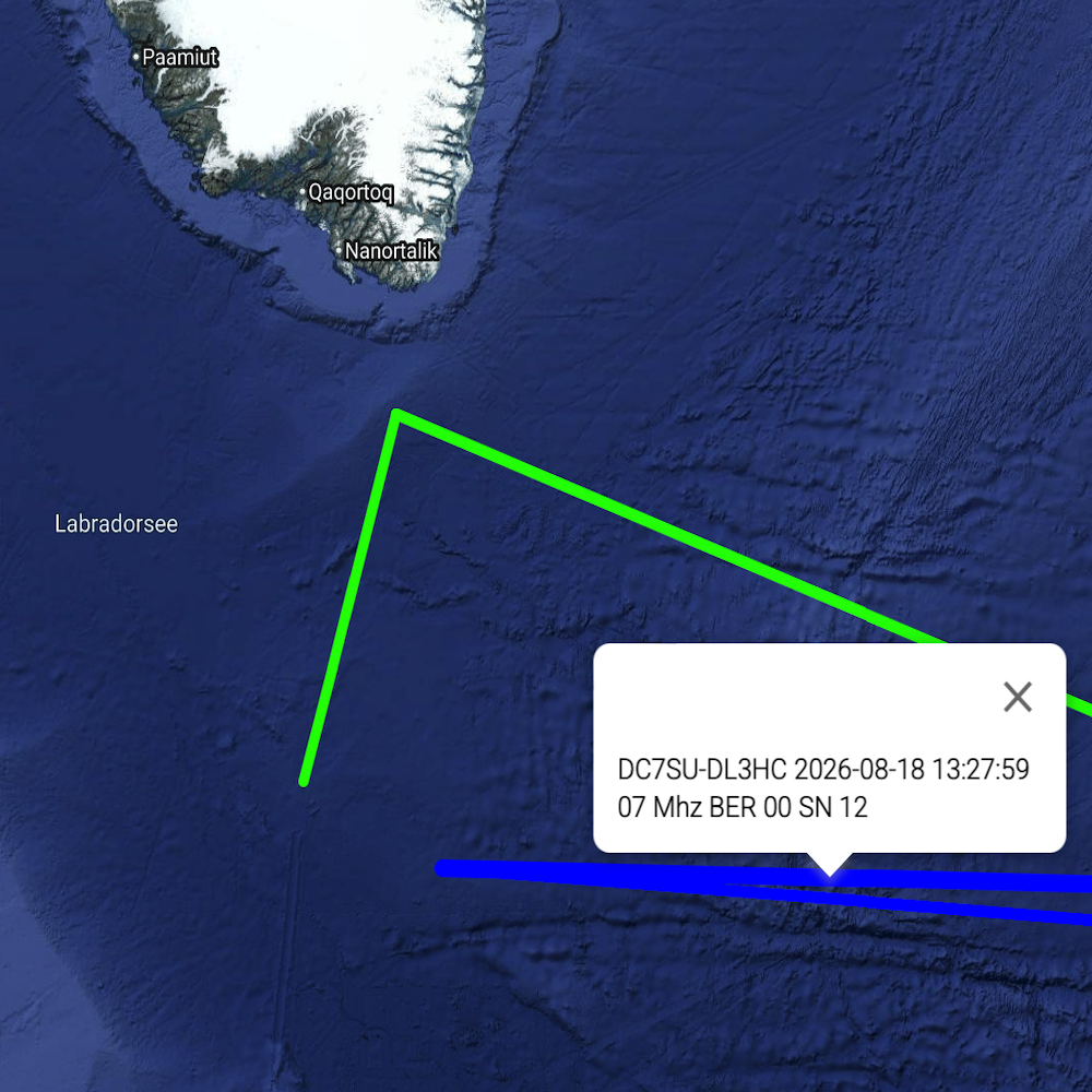
When you report to hflink.net/maps for the first time – regardless of the software used – you (or rather, your station) will appear on the map somewhere in the Labrador Sea, south of Greenland.
This is because hflink.net does not import location data from the specific program; instead, you have to enter it into hflink.net yourself.
I would like to show you how to do this — both on a desktop, and on a mobile device.
I am assuming that you have already registered with hflink.net and have an account.
First, go to the landing page hflink.net, where you will see a sort of chat window. Click the « Panels » icon above that window:
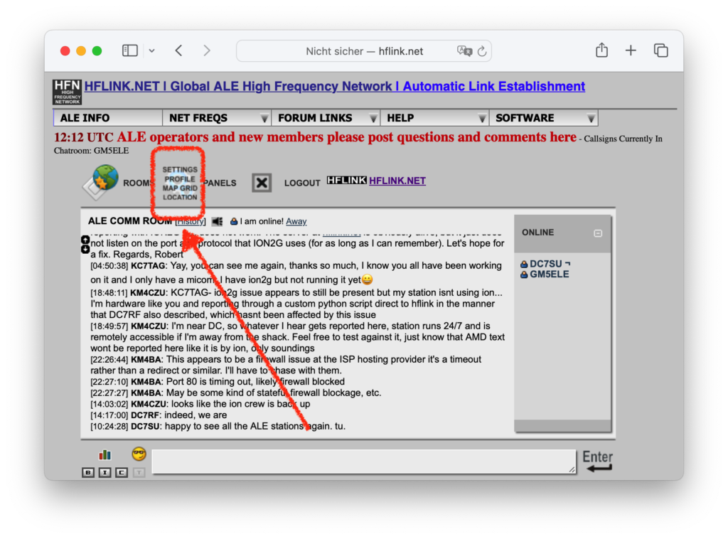
Now click on PROFILE in the dark gray bar at the bottom.
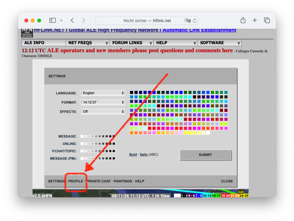
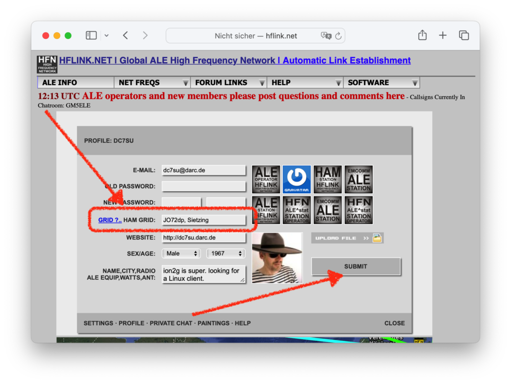
Now you can enter a Maidenhead locator at HAM GRID: Optionally the place name after a space; any string, maximum 9 bytes long.
By the way: grid.radio from Rose, M1RXO, offers a nice way to determine your locator.
Now, don’t forget to click the SUBMIT button.
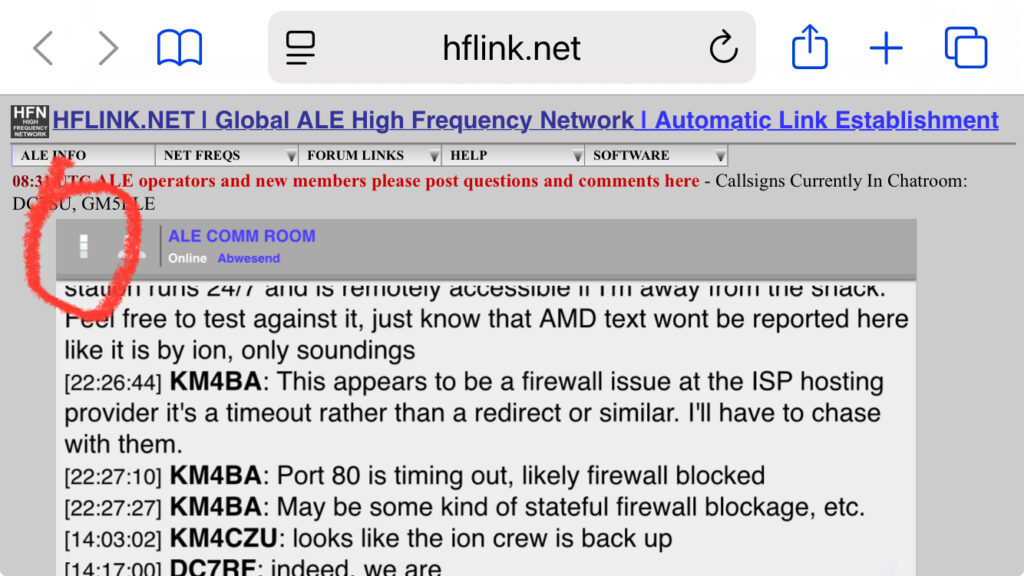
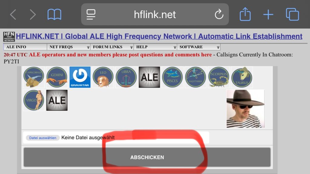
Here, too, go to the landing page (?) hflink.net, where you can see the chat window. Click on the stack of three squares above that window:
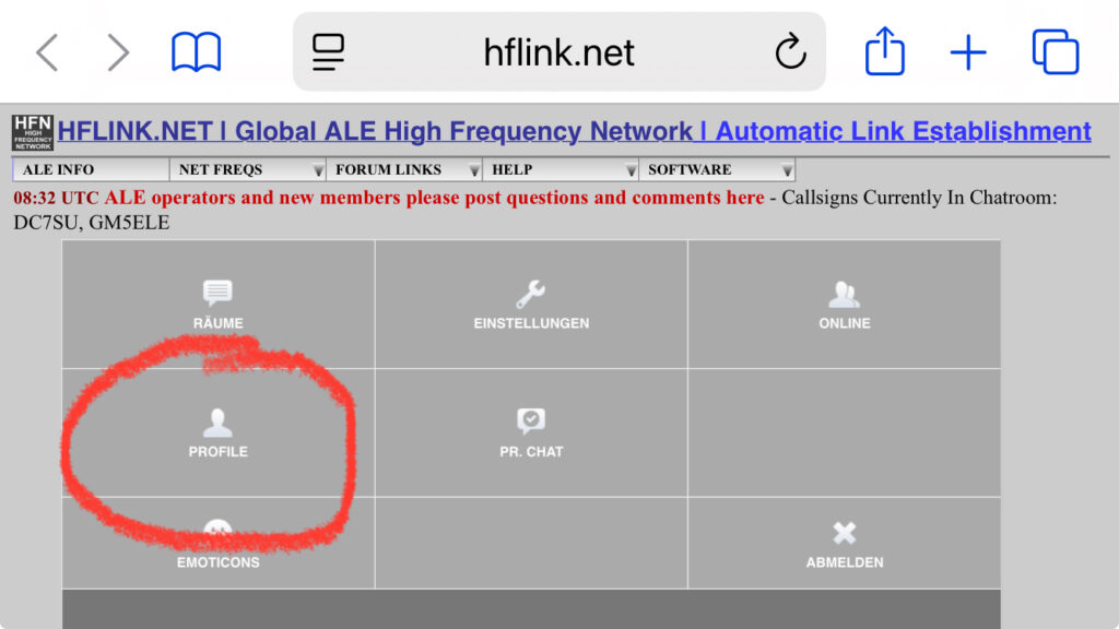
Click PROFILE now:
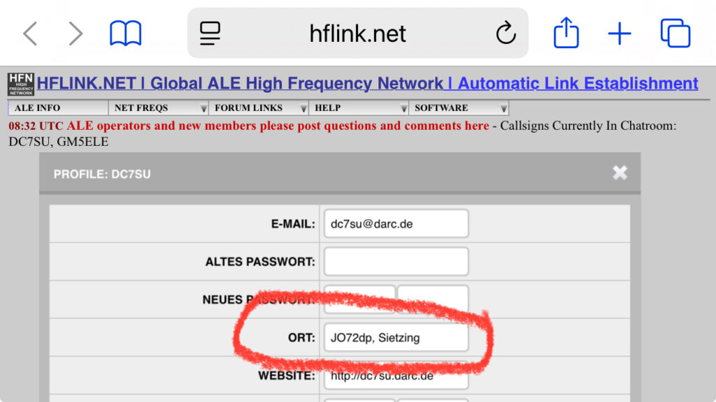
And then enter the locator that you determined at
grid.radio by Rose, M1RXO.
Then scroll all the way to the bottom of the profile frame and click SUBMIT.
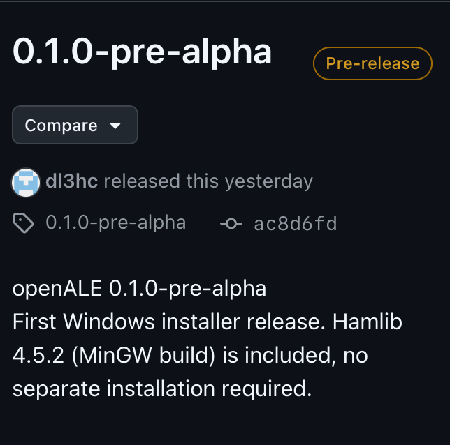
Chris (dl3hc) a mis en ligne un tout premier fichier setup.exe sur son compte GitHub.
Il s’agit d’une version alpha, voire pré-alpha ; essayez-la donc simplement sur un PC, jetez-y un œil et faites part de vos retours.
Vous pouvez le télécharger ici : https://github.com/dl3hc/openALE/releases/
Tom, dm6ts travaille à la création d’une image pour Raspberry Pi qui devrait être disponible à la fin de la semaine prochaine.
Ce message a pour but de décrire brièvement comment j’ai (Henrik, DC7SU) découvert ALE.
Passionné de radioamateurisme et de voile, et ayant eu l’opportunité d’installer une antenne ondes courtes depuis 2025, j’ai acheté un IC-7300 et une antenne demi-onde alimentée en extrémité (EFHW). Je l’ai tendue à 2 mètres du sol, comme une corde à linge.
Je me suis alors dit que je pouvais désormais participer à INTERMAR, l’association des radioamateurs navigateurs. J’ai vu sur leur site web qu’ils recherchaient des « responsables de réseau » et j’ai donc posé ma candidature.
Malheureusement, je n’ai pu réaliser que très peu de contacts ondes courtes. Heureusement, j’étais en contact avec d’autres radioamateurs (Y 36), et grâce à l’aide de Klaus et Thomas, mon antenne EFHW est maintenant installée en antenne inclinée sur un mât de près de 10 mètres de haut.
Je me suis donc dit que je pouvais désormais participer à INTERMAR, l’association des radioamateurs de voile. Tom, d’INTERMAR, m’a expliqué qu’il existait une station à Bruchsal contrôlable à distance. Cela me permet de gérer le réseau plus efficacement depuis Berlin, où je dispose d’une connexion internet fiable.
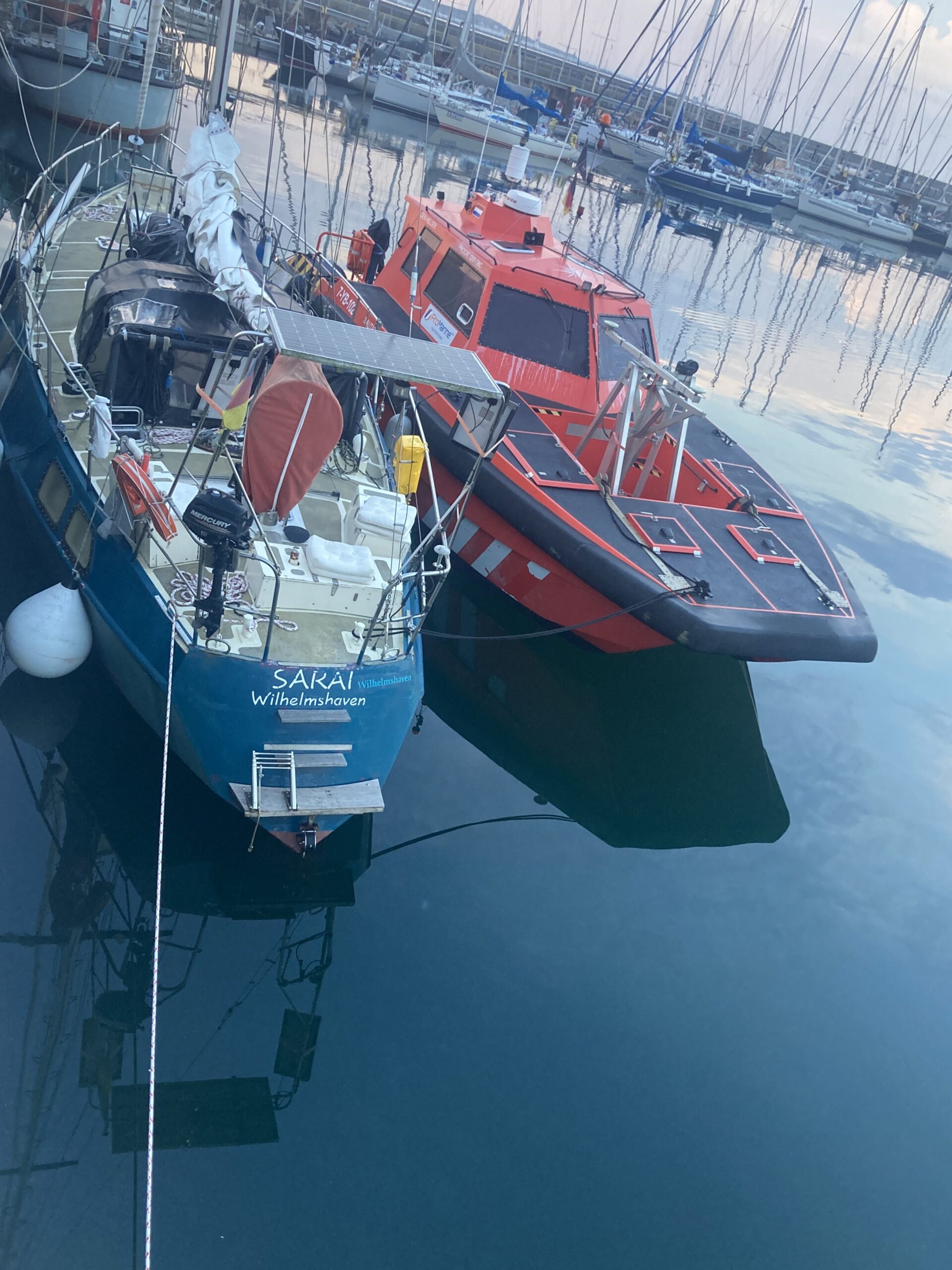
Je me suis si bien entendu avec Tom qu’il m’a invité à une croisière sur son voilier « Sarai ». Nous avons passé une semaine formidable en mer du Nord, à faire connaissance. Je lui ai présenté le DMR (Digital Mobile Radio) et l’openGD77, et il m’a initié à des sujets comme l’ALE (Automatic Link Exchange).
Pour tester l’ALE, j’ai téléchargé le logiciel ion2g. Robert, de Berlin, m’a été d’une grande aide pour l’installation et la configuration.
Tom, fervent défenseur du logiciel libre et programmeur lui-même, m’a fait découvrir PC-ALE 2.0 d’Alex Pennington et openALE de Christian « Chris » Reineke.
Ce serait formidable, bien sûr : il suffirait de brancher un Raspberry Pi à la radio via USB et le tour serait joué. On aurait alors enfin le marin qui sait quand et sur quelle fréquence il peut communiquer en ondes courtes, et qui peut également récupérer des données GRIB via WinLink…